Contents
Copyright 2002-2021 John Navas, All Rights Reserved.
Permission
is granted to copy for private non-commercial use only.
Suggestions and
corrections may be sent to
John Navas
This information was compiled by the author and is provided as a public
service. The author is not responsible for any errors or omissions,
or for any consequential problems that might result. USE AT YOUR OWN
RISK.
|
|
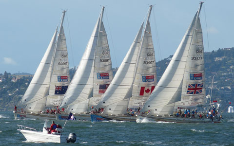
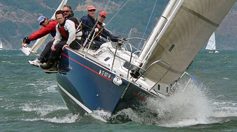
\ Clipper Round the World 2010 © John Navas /
\ 505 North American Championship 2009 © John Navas /
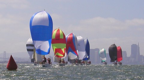
\ Spring One Design 2008 © John Navas /
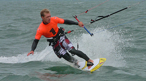
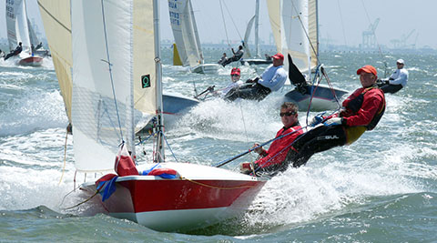
\ U.S. Kiteboarding Nationals 2007 © John Navas /
\ Albert T Simpson Sportboat Regatta 2007 © John Navas
/
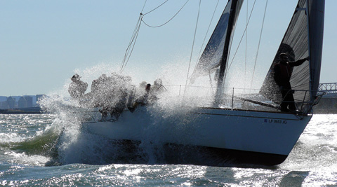
\ Big Boat Series 2005 © John Navas /
|
Links & Resources
- Associations
- Buying & Selling
- Calendars
- Fleets
- Fast Boats
- Foul Weather Gear
- Cleaning (links to
REI)
- Manufacturers
- Retailers
- Waterproofing (links to
REI)
- Fuel
- Fun
- Government
- Information/Resources
- Insurance
- Internet Access (Wireless)
- Knots
- Line Sizes
| |
| inch |
1/8 |
3/16 |
1/4 |
5/16 |
3/8 |
7/16 |
1/2 |
9/16 |
5/8 |
3/4 |
7/8 |
| mm (metric) |
3 |
5 |
6 |
8 |
9/10 |
11 |
12 |
14 |
16 |
18/19 |
22 |
|
- Maintenance
- Manufacturers
- Aerogel Insulation
- Anchor Buddy
- Kellet (angel, chum weight, sentinel)
- Elastic Rode
- Autopilots
- Canvas (covers, etc.)
- Carbon Fiber Tubes (spinnaker poles,
etc.)
- Cleat Guards (prevent running
rigging snagging on horn cleats, aka cleat boots, chocks, covers)
- Cordage (rope)
- Cushions
- Embroidery (e.g., caps/hats)
- Flags (e.g., battle flags)
- Gloves
- Gill
(old style Championship & Pro excellent, new style 2010+
not recommended)
- Harken
(Black Magic
not recommended)
-
Henri Lloyd
- Ronstan
(good basic gloves)
-
West Marine (West Marine
brand not recommended)
- GPS
- Harnesses & Ascenders
- Headlamps
- Instruments
- LED Lights (new installs &
incandescent replacement bulbs)
- Marine Hardware
- Miscellaneous
- Models
- Prefeeders, Opening
(cool)
- Rigging Cutters
- Sailmakers
- Screen Printing (T-shirts, etc.)
- Spars
- Tape (duct, gaffers)
- Tools
- 2-way Radio Headsets
Features to consider: water resistance,
VOX (voice-activated
transmission), headset compatibility, multi-station operation, security
(eavesdropping)
- Marine Supplies
- Motion Sickness (start treatment
the night before)
- Navigation
- Charts
- GPS Resources
- GPS/Navigation Software
- Navigation Resources
(free downloads)
- Press/Media
- Racing
- Associations
-
Pacific Cup
- Software
(Android mobile apps)
- Software
(onboard)
- Software (scoring)
- Transpac
- Safety
- AIS (Automatic Identification System)
- Real-Time Ship Positions in/near San Francisco Bay
- Class A
- Class B
- EPIRB (Emergency Position-Indicating Radio Beacon)
Rental
It is recommended that
boaters traveling outside of reliable VHF range carry a 406 EPIRB onboard
their vessel
- Hypothermia (a serious danger in Northern
California waters)
- Personal AIS MOB
- Personal Location Beacon (PLB)
Effectively a personal EPIRB, the cost is
now low enough that a PLB is recommended for anyone going offshore
- PFD
(Personal Floatation Device)
- Radar Transponders
- Safety
at Sea Videos (UK-Halsey, free registration required, MOB quick
stop) (recommended)
-
Safety Tips (US SAILING)
- Satellite Phone Rental
- SPOT Satellite
Messenger (inexpensive alternative to PLB)
(recommended)
- United States Coast Guard
- Vessel Assist
-
VHF Radio with DSC
and GPS
- Services
- Beadblasting (roughen winch drums)
- Boat Yards
- Charters/Rentals
- Delivery
- Design (Naval Architects)
- Diesel Service
- Electrical
- Instruction
- Photographers
- Race Management
- Refrigeration
- Riggers
- Surveyors
- Tide, Current, and Wind
- Currents
- National Data Buoy Center (real-time
offshore wind and wave data)
- NPS Meteorology Department
- PassageWeather (worldwide
wind and wave forecasts)
- QuikSCAT
(Ocean Surface Winds Derived from the SeaWinds Scatterometer)
-
San
Francisco Bay PORTS (NOAA) 866-727-6787 (866-SBPORTS)
- San Francisco Bay Wind Patterns (San Jose State, real time)
(new home!)
- Software
- WXTide32 (tide & current
prediction, free)
- WWW Tide-Current Predictor
- U.S. West
Coast sites
-
San Francisco Bay Entrance (Golden Gate), California Current
-
Golden Gate Bridge .8 mi E ., San Francisco Bay, California Current
-
Raccoon Strait off Point Stuart, San Francisco Bay, California Current
-
Point Richmond .5 mi W, San Francisco Bay, California Current
-
Treasure Island .5 mi N, San Francisco Bay, California Current
-
Alcatraz Island S, San Francisco Bay, California Current
-
South Channel, San Francisco Bay Approach, California Current
- Weather
- Webcams
- Yacht Clubs
Weather, Tide & Wind by Cell Phone
Voice
- NOAA
National Ocean Service
PORTS (Physical Oceanographic
Real-Time Systems) information (real-time water levels, currents, and other
oceanographic and meteorological data from bays and harbors) is available through
a free automated voice telephone service:
- For San Francisco, call 1-866-727-6787
- For other areas, see
PORTS on the Web
- WeatherWave
Subscription
service that delivers very fast severe weather alerts to boaters’ cell phones
as computer-generated voice calls.
WAP
Certain cellular phones (and other wireless devices) are capable of accessing
certain information on the World Wide Web by means of a built-in
WAP browser.
Unfortunately, most of the information on the Web is not accessible by WAP because
most Web sites lack the specific support for WAP and small screens that is normally
required. That pretty much limits WAP devices to a relatively small number of WAP-enabled
Web sites, a selection of which is commonly listed for convenience by wireless carriers.
Although weather is one of the information sources commonly provided through
WAP, it generally doesn't include things that are of importance to mariners
like tides. Such information is available on the non-WAP Web (see "Tides &
Wind" and "Weather" above);
the challenge is to get at it by WAP.
Fortunately, it is possible to access non-WAP Web pages by means of WAP
if the page is in standard
HTML, and is small and clean
enough for the limited capacity and screen size of WAP devices. The challenge is
to find such pages--the great majority of pages don't meet these requirements.
Here are two useful pages for the San Francisco Bay Area that do meet these requirements:
Cingular subscribers can save links to these
resources for fast access on their personal MEdia Net Home page (accessed
with the Cingular logo button on many Cingular-branded phones) in My Links.
Cingular provides good marine coverage along the coast, with service in most areas
near San Francisco, from Drakes Bay down to Monterey, up to about 20 miles offshore.
A good way to access Web resources over WAP is to use
Google Mobile, which converts search
results into a form that works on most WAP-enabled cell phones. For example, search
for "NDBC 46026" to find the Web page for the San Francisco data buoy
(18NM West of San Francisco), then click on the result link to have Google display
the result
in WAP format on your cell phone, showing winds, waves, temperature, etc.
Yet another option if your cell phone is Java-capable, is the free
Opera Mini for Mobile
Web browser, which does a remarkable job of browsing full Web pages on a small screen.
Racing Marks and Courses
DISCLAIMERS: Provided for information purposes only--should not be
used for navigation. Positions of some marks have only been estimated, and may differ
significantly from actual positions (particularly the temporary marks). USE AT YOUR
OWN RISK.
Suggestions and corrections may be sent to
John Navas
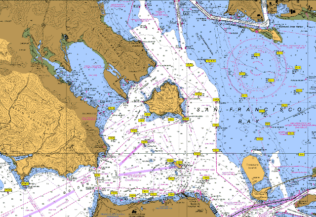
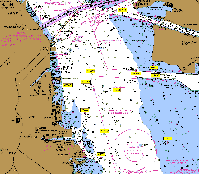
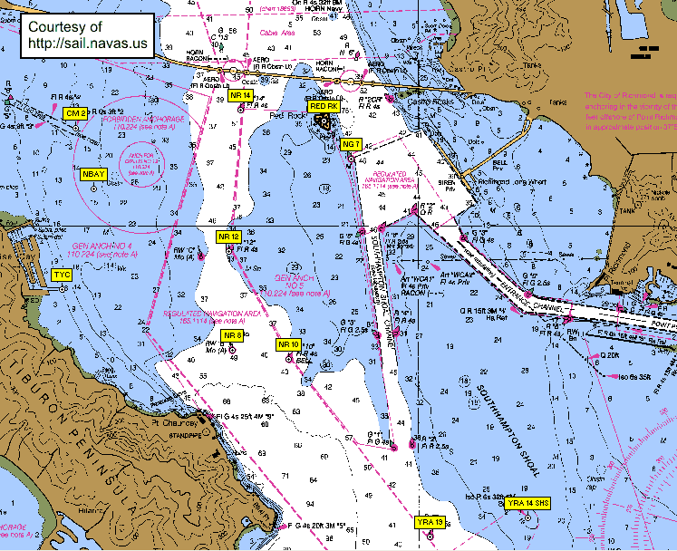
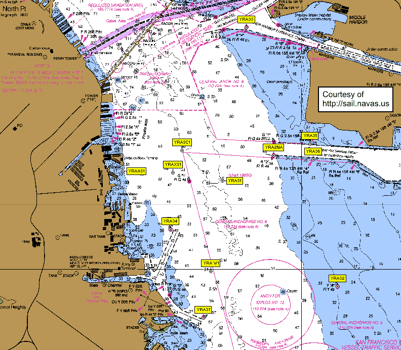
Central Bay Chart
(click on image for high resolution version)
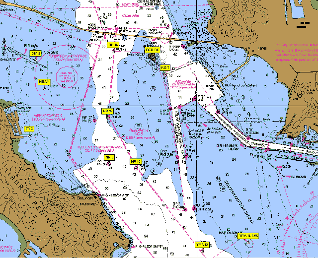
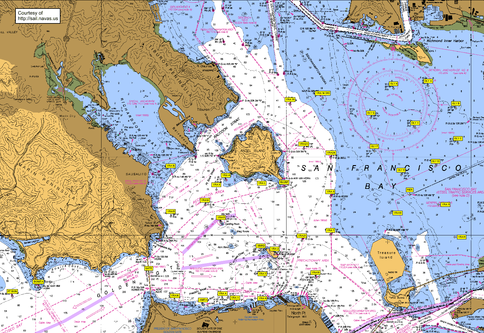
North Bay Chart
(click on image for high resolution version)
South Bay Chart
(click on image for high resolution version)
GPS Coordinates and Courses
These GPS waypoint (and route) files are in
GPX (GPS Exchange format), an open,
flexible and well-documented format supported by
many GPS programs, including
EasyGPS (see
note) and
GPSBabel (both free), which can be used to
upload/download to/from many popular GPS units, and view and/or edit GPS waypoints
and routes. (You may need to right-click on links to download the GPS Exchange
format files.)
- Update History
(last update: 05/02/2006)
- Central Bay mark positions
- Knox courses 1-16
- North Bay mark positions
- OYRA courses
- South Bay mark positions and courses
- YRA (official)
Other Mark References
 |
|
About the Author
John Navas is experienced in racing all types of sailboats from dinghies
to large offshore racers. Most recent experience includes: Santa Cruz 52,
50; Farr 52, 40; Beneteau First 47.7, 42s7, 40.7, 36.7; Holland 47; Express
37, 27; J/120, J/35, J/105, J/24; 1D35; Santana 35; T-10; Olson 30; Newport
30; Knarr, Moore 24. Four times Banshee National Champion, raced in O'Day
(U.S. Singlehanded) Championship, NEISA Champion, plus a number of regional
and fleet championships. West Coast offshore racing includes Coastal Cup,
Transpac, and Ensenada. Also match and team racing experience.
|
| |
| This page has been viewed |
|
times. |
| |
 |
|
Trademarks belong to their respective owners |
| |
 |
Best web browser |
|
 |
Best email client |


